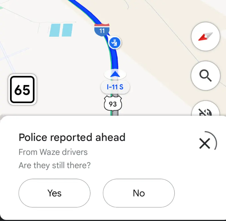
Google is bringing incident reports from Waze directly into the Google Maps app, creating a more comprehensive navigation experience for users. The new feature allows drivers to see reports originally shared on Waze, with clear attribution to the source app.
Users will now encounter bottom sheets in Google Maps that show incidents like police alerts. These reports come with a “From Waze drivers” tag and include an interactive element asking users to confirm if the incident is still present. The reporting panel automatically disappears after a short countdown.

This integration is part of Google’s broader strategy to improve mapping services. Google Maps, which boasts over 2 billion monthly active users, will benefit from Waze’s crowdsourced reporting system. Waze, with approximately 151 million users, specializes in real-time road condition reporting.
Both apps are managed by Google’s “Geo” team, which aims to create a more interconnected navigation ecosystem. While Google Maps remains a general-purpose mapping tool, Waze focuses on community-driven incident reporting.
The feature currently starts with police alerts, with plans to expand to more types of incident reports in the future. This bi-directional data exchange promises to enhance the navigation experience for drivers across both platforms.
As the rollout continues, users can expect more seamless sharing of road information between Waze and Google Maps.


