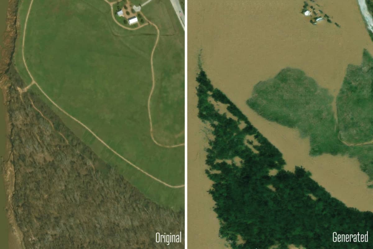
MIT scientists have developed an innovative AI tool that generates realistic satellite images of potential future flooding.
The method combines generative artificial intelligence with physics-based flood models to create accurate, bird’s-eye-view visualizations of how regions might look during extreme weather events.
Researchers tested the tool by simulating flooding scenarios around Houston, comparing AI-generated images with actual satellite photos from Hurricane Harvey.
Unlike previous AI-only approaches, this new method incorporates physical parameters like hurricane trajectories and flood patterns to reduce inaccuracies.
The goal is to provide more intuitive and engaging flood risk visualizations that can help communities better prepare for potential disasters.
By offering hyper-local perspectives of climate risks, the tool could help encourage evacuations and improve emergency preparedness.
Björn Lütjens, the study’s lead researcher, hopes the tool can become a valuable resource for communicating climate risks. The team has made their “Earth Intelligence Engine” available online for further exploration and development.
This breakthrough demonstrates how AI can be combined with scientific modeling to create more trustworthy and informative climate risk visualizations.


